





Book Now : 1-844-360-1553
Belize Reservations Office
Phone: +501-226-4297
Phone: 1-844-360-1553
WhatsApp: +501-670-4811
E-mail: [email protected]


Close
Belize Activities & Adventures
Caracol Belize: History, Caana & Guide to the Ancient Maya City
Nov 13, 2026
A visit to Caracol Belize begins before you see the ruins. Birds call from the canopy, crickets fill the quieter […]
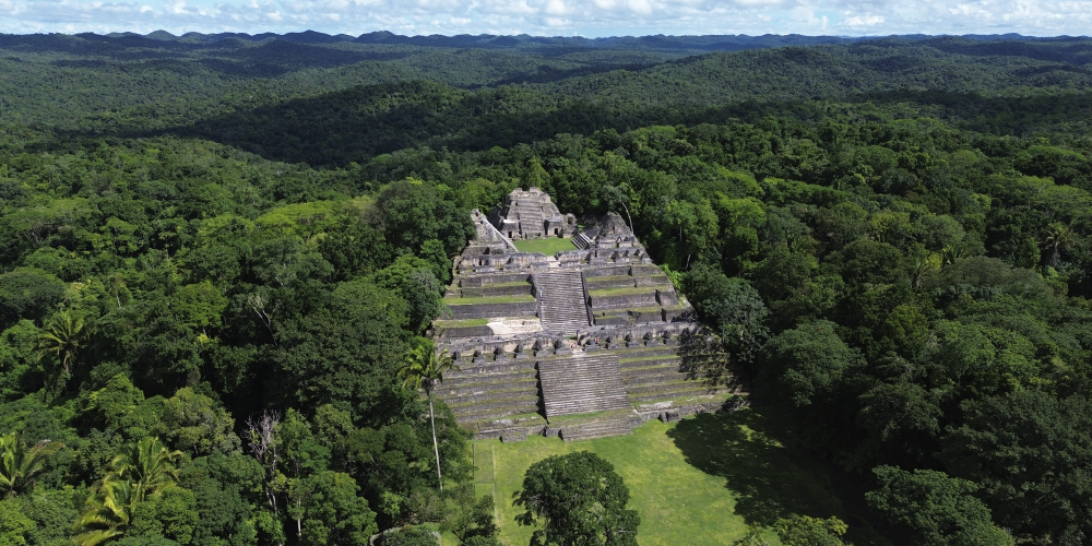
A visit to Caracol Belize begins before you see the ruins. Birds call from the canopy, crickets fill the quieter spaces between them, and enormous trees rise along the short walk from the check-in area. Then, after only a few minutes, the forest opens, and the first stone structures come into view.
That arrival gives you a sense of what makes Caracol different. The ruins do not sit beside a modern town or busy highway. They rise from the forest, surrounded by trees and wildlife, with enough distance from everyday life that it becomes easier to imagine just how different this place must have felt when it was a thriving Maya city.
Caracol was not a small settlement. It became one of the most important political centers in the ancient Maya world, with monumental architecture, extensive residential areas, and rulers whose conflicts with cities such as Tikal and Naranjo are still recorded in its monuments. Today, you can climb through the Caana complex, walk across ancient plazas, listen for wildlife in the surrounding forest, and stand in a place where archaeologists are still uncovering new pieces of the story.
To understand why the site feels so impressive when you finally step into those plazas, it helps to first understand just how large and powerful Caracol once was.
Caracol Belize Quick Facts
| Quick Fact | Details |
| Location | Chiquibul Forest Reserve, Cayo District |
| Distance from San Ignacio | About 50 miles |
| Archaeological reserve | About 25,000 acres |
| Peak urban area | NICH estimates approximately 38 square miles |
| Population | NICH estimates about 80,000–100,000 at its political peak |
| Most famous structure | Caana |
| Caana height | About 139 feet |
| Major political events | Defeat of Tikal in AD 562; conquest of Naranjo in AD 631 |
| First known dynastic ruler | Te K’ab Chaak |
| Major recent discovery | Te K’ab Chaak’s tomb, announced in 2025 |
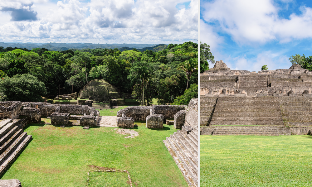
NICH describes Caracol as Belize’s largest archaeological reserve and estimates that the city covered around 38 square miles at the height of its political power, with a population of roughly 80,000 to 100,000.
How Large Was Ancient Caracol?
The plazas and temples visitors explore today represent only a small part of the ancient city. Archaeologists have mapped residential groups, agricultural terraces, reservoirs, causeways, and other infrastructure extending far beyond the monumental center.
That scale is important because Caracol was not simply a ceremonial complex where people occasionally gathered. It was an urban landscape where tens of thousands of people lived, farmed, traded, worshipped, and moved between neighborhoods connected to a larger political center.
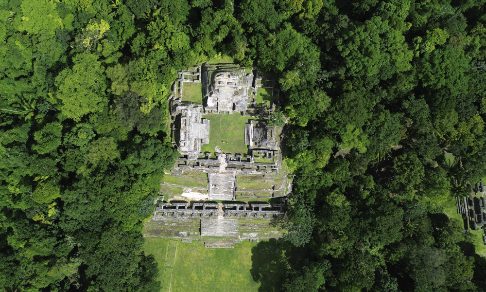
Long-term research has also changed how archaeologists think about Maya urban life. Excavations at Caracol have taken place not only in monumental architecture but also among house mounds, agricultural fields, and residential areas, providing a broader picture of everyday life beyond the ruling elite.
Where Is Caracol in Belize?
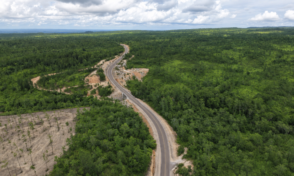
Caracol lies within the Chiquibul Forest Reserve in western Belize, approximately 50 miles from San Ignacio. NICH lists the archaeological reserve at about 25,000 acres.
The location is part of what shapes the experience. Unlike Cahal Pech, which sits close to San Ignacio, or Xunantunich, which is easier to reach from populated areas, Caracol feels noticeably removed from modern settlement.
As you travel farther into western Belize, houses and businesses become less frequent, and the landscape becomes increasingly green. By the time you reach the archaeological reserve and walk through the trees toward the first plazas, the distance makes sense. It feels less like arriving at a roadside attraction and more like travelling into another part of Belize entirely.
If you are still deciding which ancient site fits your trip best, our Belize Mayan Ruins guide compares Caracol with Xunantunich, Lamanai, Altun Ha and other archaeological sites around the country.
Why Was Caracol Important?
Caracol’s importance came from more than its size. It was a major political and military power whose rulers were involved in relationships and conflicts with some of the most influential cities in the Maya lowlands.
Its extensive road network, agricultural system, and residential development also show that this was a highly organized city. Researchers have spent decades studying how Caracol supported such a large population and how life outside the ceremonial center compared with life closer to the ruling elite.
That history becomes particularly interesting when you stand among the ruins. Structures that initially look separate begin to make more sense once you understand how the plazas, monuments, rulers and political events connected.
Caracol, Tikal and Naranjo
Caracol’s hieroglyphic history records one of its most important military events in AD 562, when it was involved in the defeat of Tikal in what is now Guatemala. Later, during the reign of K’an II, Caracol fought a series of wars against Naranjo that culminated in another major victory in AD 631.
These events help place Caracol within the wider Maya world rather than treating it as an isolated city hidden in Belize’s forest. Its rulers were participating in regional alliances, rivalries, and conflicts that stretched well beyond the boundaries of present-day Belize.
This was one of the biggest differences between our first and second visits. The second time, we went with a knowledgeable guide who explained how the structures and monuments related to the history behind them. It felt as though the missing pieces of the puzzle had been added; instead of seeing individual ruins, we began to understand them as parts of a city with its own political story.
The 2025 Discovery of Caracol’s First Known Ruler’s Tomb
Caracol’s archaeological story is still developing. In 2025, archaeologists Arlen and Diane Chase and their team announced the discovery of the tomb of Te K’ab Chaak, Caracol’s first known ruler and the founder of its royal dynasty.
Te K’ab Chaak acceded to the throne in AD 331. His tomb contained eleven pottery vessels, carved bone tubes, jadeite jewelry, a mosaic jadeite mask, Pacific spondylus shells, and other materials. It was the first identifiable ruler’s tomb found in more than four decades of archaeological work at Caracol.
The discovery is particularly valuable because archaeologists could connect the burial with a ruler already known through Caracol’s hieroglyphic record. Evidence from the tomb is also contributing to the continuing discussion about early connections between the Maya world and Teotihuacan in central Mexico.
The find was later named one of Archaeology Magazine’s Top 10 archaeological discoveries of 2025. For visitors, discoveries like this are a reminder that Caracol is not simply an ancient place whose story has already been completed. Archaeologists are still finding evidence that changes how the city’s rulers, political relationships, and early history are understood.
What to See at Caracol Belize
A typical visit concentrates on the excavated center rather than the enormous extent of ancient Caracol. Within that area, you can move through broad plazas, monumental architecture, ball courts, and smaller structures while the forest remains visible around and between them.
A knowledgeable guide can make a noticeable difference here because some of the most interesting details are easy to walk past. A carved monument or partially restored structure becomes much more meaningful once you understand where it fits within the city.
Caana: Caracol’s Famous “Sky Place”
Caana is the structure most visitors associate with Caracol. The complex rises approximately 139 feet, and NICH currently describes it as Belize’s tallest building.
Standing at the base, photographs do not quite prepare you for the scale. There are also more steps than at some other Maya sites, but the climb is not simply one continuous staircase straight to the top.
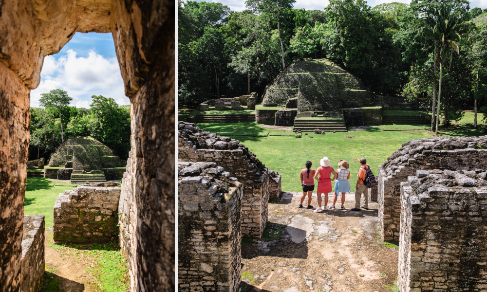
Different levels give you room to stop, walk around, and explore before continuing upward. You can move through sections of the complex, see the surrounding structures from new angles, and take a break before climbing higher.
When access is permitted, those levels make Caana particularly interesting because the experience changes as you ascend. Always follow current NICH signage and site instructions, as access to archaeological structures can change for safety or conservation reasons.
Looking Out from Caana
Reaching the upper levels gives you a very different perspective on the archaeological site. The plaza where you began suddenly looks far below, while forest stretches beyond the excavated center.
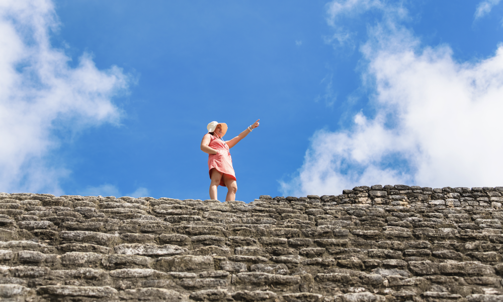
That was the point where the history felt most tangible to us. Looking down from Caana, it was difficult not to imagine what the scene might have looked like when Caracol was a populated city rather than an archaeological site surrounded by forest. The question is not only what the buildings looked like, but how many people would have been moving through the plazas and how different the surrounding landscape would have appeared.
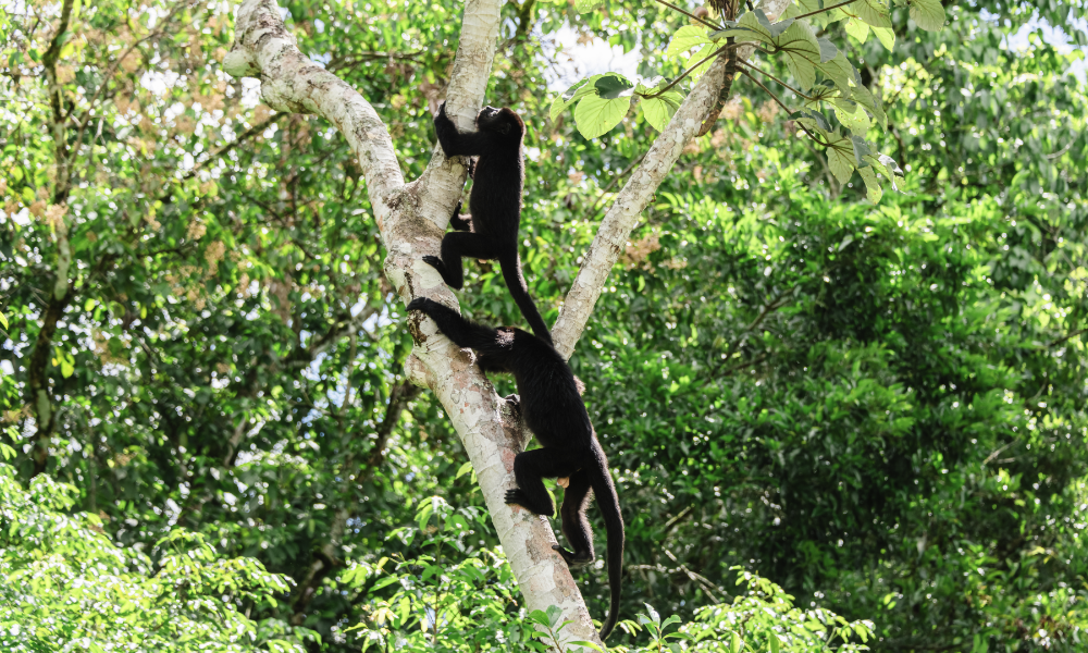
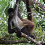
On one visit, the descent offered another memorable moment as a group of monkeys moved through the nearby treetops. We stopped along the way to watch them and take photographs before continuing down, which was a reminder that wildlife is not separate from the Caracol experience; the forest is always around you.
Ancient Plazas and Structures
Caracol’s broad plazas are surrounded by temples, palace structures, and other buildings associated with political, ceremonial, and residential life. Some have been extensively excavated and stabilized, while other mounds remain partly reclaimed by vegetation.
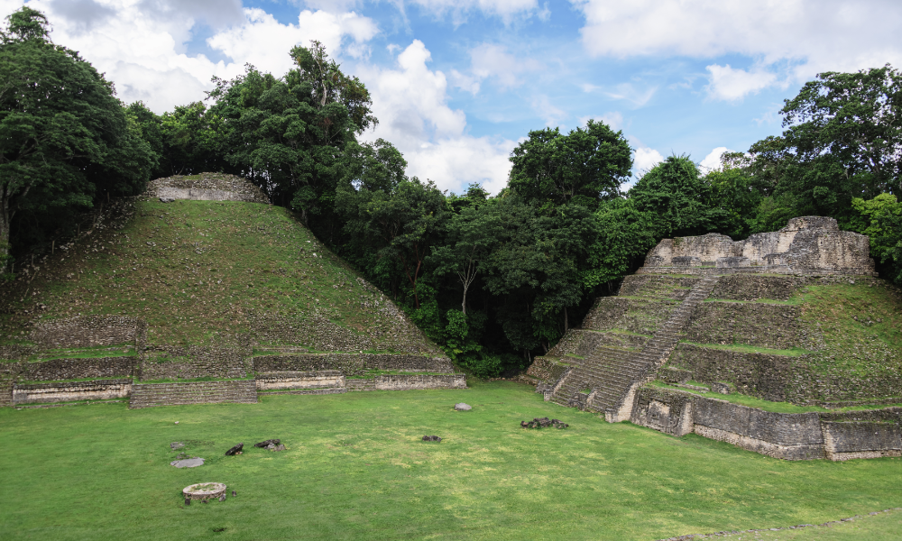
That contrast helps put the archaeological work into perspective. What visitors see today is the exposed portion of a much larger ancient city, while other parts remain beneath and among the forest.
Ball Courts and Carved Monuments
Caracol also contains ball courts associated with the ancient Maya ballgame, which carried political, ritual, and social importance. One of the site’s most significant finds, Altar 21, came from the A Group Ballcourt and contains a long hieroglyphic text documenting Caracol’s AD 562 victory involving Tikal.
Carved stelae and other monuments preserve dates, rulers’ names, ceremonies, and political events. When you know what those stones helped reveal, they become far more interesting than simply another archaeological feature along the path.
The Jungle Is Part of Caracol
Caracol is often described as Maya ruins surrounded by jungle, but the forest is more than a backdrop. It affects the entire atmosphere of the site, from the walk before the ruins first appear to the birds and insects you hear while crossing the plazas.
It is not silent, but it feels peaceful. Birds call from the trees, crickets fill the background, and monkeys may occasionally be heard or seen moving through the canopy. Compared with town life, the sounds are completely different.
One of the things we now look for whenever we visit is the long hanging nests of Montezuma Oropendolas. Their unusual calls are among our favorite sounds in the forest and have become part of the feeling of arriving at Caracol.
That natural setting also makes the archaeological site particularly appealing to travelers whose interests overlap. You can come for Maya history and find yourself watching birds between structures or stopping because something is moving through the canopy.
Ceiba Trees and a Different Sense of Scale
On one guided visit, our guide identified enormous buttress-rooted trees near the archaeological area as ceibas. Standing between them was one of the quieter moments of the visit because the trees created another sense of scale entirely.
The ruins already make you feel small, but so do those huge trunks rising into the canopy. It is hard not to wonder how long they have been growing there and how many changes have taken place around them.
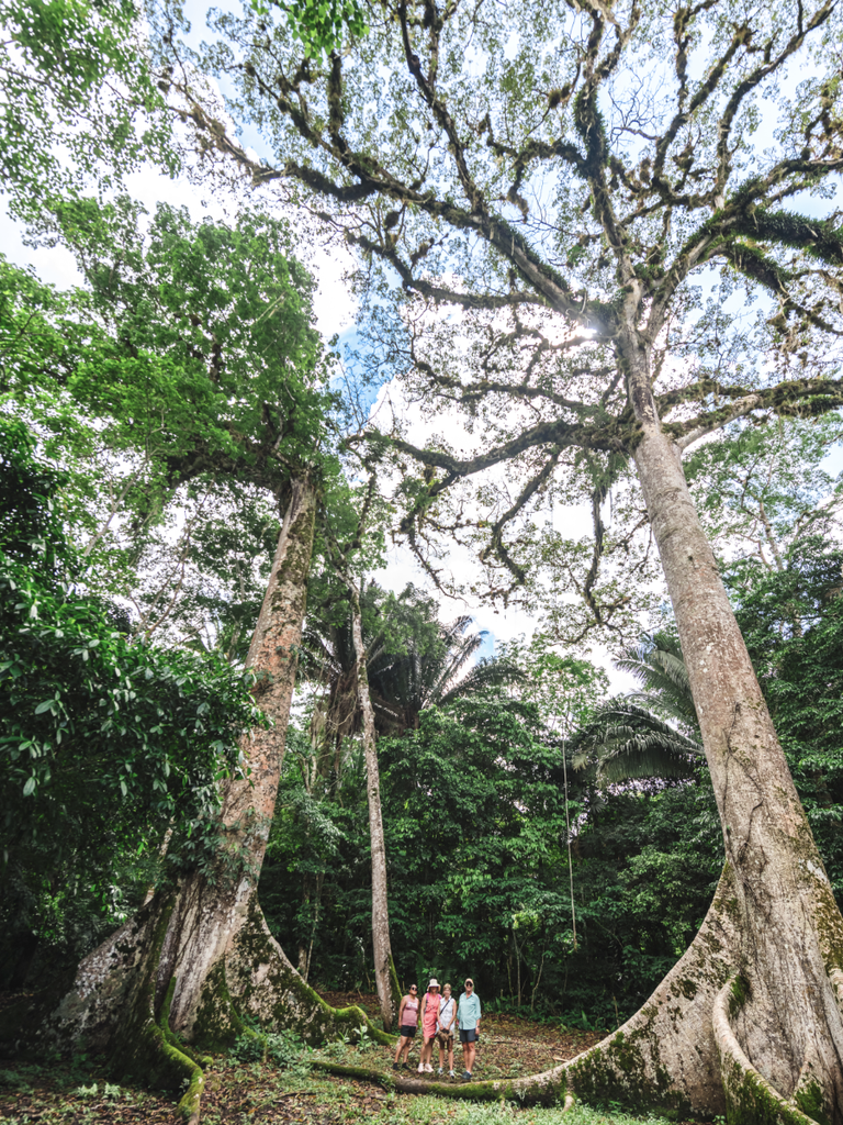
That combination of architecture and forest is one of Caracol’s strongest qualities. The ancient city never feels completely separated from the landscape that has grown around it.
Is Caracol Good for Birding and Nature?
Caracol is particularly well suited to nature lovers and birders because you do not have to choose between an archaeological experience and time in the forest. Both happen during the same visit.
Birding can begin on the drive, continue around the check-in area, and carry on while you move through the site. Wildlife sightings are never guaranteed, but slowing down and listening makes the experience noticeably richer.
For photographers, the combination is equally interesting. Stone structures, forest canopy, giant trees, changing light and wildlife all provide opportunities beyond the standard photograph of Caana.
Who Should Visit Caracol?
Caracol is especially rewarding for travelers interested in Maya history, archaeology, nature and birding. It also suits photographers and travelers who enjoy spending a full day exploring somewhere that feels far removed from Belize’s busier destinations.
The commitment is greater than visiting a site close to San Ignacio, but that is also part of Caracol’s appeal. The drive, changing landscape, forest and ancient city become parts of the same experience rather than separate pieces of the day.
If your main question is how Caracol compares with Belize’s other archaeological sites, our Belize Mayan Ruins guide is the better place to compare your options before deciding which sites to add to your itinerary.
Is Caracol Belize Worth Visiting?
For us, Caracol is worth visiting because the ruins are only one part of the experience. What stays with you is the short walk through the forest before the plazas appear, the sound of birds and crickets, the hanging oropendola nests, enormous ceiba trees, and the view from Caana across a landscape that once supported a major Maya city.
A guide can also make the visit substantially better if you are interested in history. Our second visit felt different from the first because the structures finally connected to the rulers, conflicts, and city life behind them instead of existing only as impressive ruins.
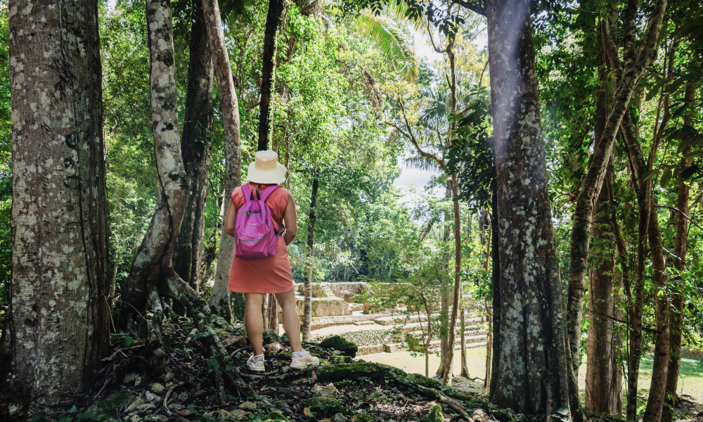
If you decide to go, give Caracol enough time to explore beyond the most obvious viewpoint. Stop at the different levels of Caana, pay attention to the monuments, and look into the trees occasionally. The details around the ruins are part of what makes the site memorable.
FAQ: Caracol Belize
What is Caracol Belize?
Caracol is a major ancient Maya city and archaeological reserve in western Belize. NICH describes it as the country’s largest archaeological reserve, covering approximately 25,000 acres within the Chiquibul Forest Reserve.
Why is Caracol important?
Caracol became one of the major political powers of the ancient Maya world. Its hieroglyphic history records the AD 562 defeat involving Tikal and a series of conflicts with Naranjo that culminated in a major victory in AD 631.
What is Caana at Caracol?
Caana is Caracol’s best-known architectural complex and rises approximately 139 feet above the site. NICH currently describes it as Belize’s tallest building.
Who was Te K’ab Chaak?
Te K’ab Chaak was the first known ruler of Caracol and founder of its royal dynasty. He acceded in AD 331, and archaeologists announced the discovery of his identifiable royal tomb in 2025.
Can you climb Caana?
Access to individual structures can change for safety and conservation reasons. Follow current NICH signage and instructions from site staff or your guide rather than assuming climbing will always be permitted.
Is Caracol good for birding?
Yes. The forest surrounding the archaeological site makes Caracol a strong choice for visitors interested in both Maya history and nature. On our visits, birds—including Montezuma Oropendolas and their distinctive hanging nests—have been part of the experience.
Is Caracol worth visiting?
Caracol is particularly rewarding for travelers interested in Maya history, archaeology, nature, and birding. Its secluded setting and scale create a very different experience from Belize’s more accessible archaeological sites.

Popular Posts
Follow Us Social Media